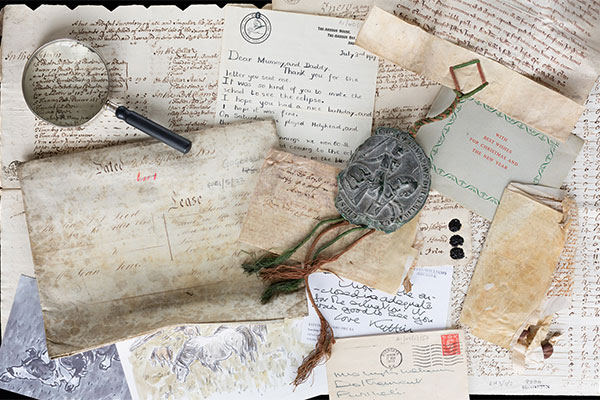
Medieval land surveys were written documents prepared from observation, writings or oral descriptions. Only during the late sixteenth century did accurate estate maps start to supplement the written surveys.
The maps, essentially private records of ownership or occupation also aided estate management and served as legal evidence in disputes and probate. Agrarian changes encouraged a constant demand for estate maps.
What are estate maps?
The National Library of Wales has a large and important collection of manuscript estate maps relating to Wales; ranging in date from the 16th century to the 20th century. Only a few large Welsh estates were surveyed before 1760, the majority of surveys being undertaken between 1760 and 1800. The term “Estate maps” is used for a wide range of plans i.e. from a map showing an individual property to large volumes depicting the entire lands of a large estate.
They also vary from being intricate, highly detailed and beautifully coloured examples to crude working drawings. These maps were intended as functional documents showing only the owner’s properties to the exclusion of unnecessary detail. These maps were usually commissioned by landowners and were created for their private use by commercial surveyors.
The earliest example is the survey of the manors of Crickhowel and Tretower (1587). From about the mid nineteenth century, maps became simpler and were increasingly based on readily available large-scale mapping in the form of tithe maps and Ordnance Survey maps, thus eliminating the need for costly private surveys. Estate maps were often once part of larger bodies of documents, many of which are held by the Library.
Estate maps often provide topographical information on features which were overlooked or simply not included by the compilers of later maps. They may be accompanied by a book of reference, or more usually a summary terrier on the map itself, detailing acreages and land use and naming tenants and fields.
A selection of digitised estate maps of Wales
Badminton Estate (Survey of the Manors of Crickhowell and Tretower, 1587, an early survey of a whole estate)
Reference: Badminton Volume 3
‘This noble survey taken of the seignoye of Chrughoel and Tretowre’, Volume 3 of the Badminton collection is one of our most important estate map volumes. Produced in 1587, it contains the survey of the Manors of Crickhowell and Tretower. It is one of the earliest surveys produced in Britain of a whole estate, carried out at a single scale, using a single style and method. It is also interesting as several later manuscript copies were produced in the 18th & 19th centuries.
Gogerddan Estate (An insight into the development and eventual decay of a landed estate in North Ceredigion)
Reference: Pre 19th century maps and Vols. 36-40 & 113
The National Library of Wales acquired the Gogerddan collection in 1949, and it provides a fascinating insight into the development and eventual decay of a landed estate in Wales. Much of the estate’s land was located in North Ceredigion, but there were also lands held near Machynlleth and further afield.
The main estate was based just outside Aberystwyth near the village of Penrhyn-coch. The mansion and other estate buildings now house the Institute of Biological, Environmental and Rural Sciences, part of the University of Wales, Aberystwyth.
In addition to individual, pre-19th century, maps, the National Library of Wales has also digitised a number of volumes containing complete surveys of parts of the estate.
Gogerddan Estate maps (Volumes)
- Llanfair Clydogau and Llanddewibrefi estates Reference: MS. Map Vol. 36
- Maps of the Gogerthan Estate in the several counties of Cardigan and Montgomery Reference: MS. Map Vol. 37
- Court Grange Estate in the county of Cardigan Reference: MS. Map Vol. 38
- Maps of the estate of Edward Loveden Loveden Esqr. Reference: MS. Map Vol. 39
- A survey of the estates of Walter Pryse Esquire Reference: MS. Map Vol. 40
- A survey of the estates belonging to Walter Pryse Esquire in the counties of Brecknock and Gloucester Reference: Gogerddan 113
Gogerddan Estate Pre-19th century loose maps
- Llwyn Nant y Dyniewid [sheepwalk] in the Parish of Llanfihangel Reference: Gogerddan 25
- Pen y Gaer in the parish of Llanfihangel geneu’r glyn Reference: Gogerddan 33a
- An accurate map of the Demeasns of Cynnill-mawr and Argoed-Vach in the parish of Llanvihangel-generglynne Cardiganshire Reference: Gogerddan 35
- Plan of the outlines of Lodge park, Hen hafod, Trwyn y Buarth and Bodfagen Reference: Gogerddan 58
- Map of Blwch-y-styllen in the parish of [Llanbadarn Fawr], Cardiganshire Reference: Gogerddan 71
- A new and correct map of the tenement of Gloucester Hall Reference: Gogerddan 78
- Gogerthan garden Reference: Gogerddan 79
- Gogerthan gardens Reference: Gogerddan 80
- Map and survey of an estate in West Challow in the County of Berks Reference: Gogerddan 101
- A farm in Wymandham [sic] in the county of Leicester Reference: Gogerddan 103
- A survey of Nantcollen, Glan-y-Mor and Tan-y-Voel farms in the parish of Llanbadarn vawr in the county of Cardigan Reference: Gogerddan 105
- A survey of Bron-y-Gof farm and some adjoining lands, part of Ucha-yn-y-Vainer township in the parish of Llanbadarn in the county of Cardigan Reference: Gogerddan 106
- Map of Cors Fochno and the several islands situate thereinwith part of the navigable River Dovey in the county of Cardigan Reference: Gogerddan 108
- A map of the Borough of Aberystwith with several farms, messuages and lands in the parish of Llanbadarnfawr and county of Cardigan Reference: Gogerddan 110
- A map of several lands and tenements situate and lying in or near the parish of Machynlleth in the county of Montgomery Reference: Gogerddan 112
- A map of part of Rhoskellan Estate Reference: Gogerddan 114a and 114b
- Gogerthan Gardens Reference: Gogerddan 115
- An accurate survey of Gogerthan Gardens and the ground adjoining with true ground plans of the present buildings Reference: Gogerddan 117
- A plan of the Mannor of Perveth commonly called Cwmmwd y Perveth Reference: Gogerddan 211
- Gogerddan Estate, Northern Cardiganshire Reference: Gogerddan 232
- A survey of Cwmbwr and Daran Vawr farms and such farms as adjoin thereto in the townships of Treveirig and Canol in the parish of Llanbadarn in the county of Cardigan Reference: Gogerddan 107
Other Gogerddan Estate maps
- Llanfair Clydogau and Llanddewibrefi estates
- Maps of the Gogerthan Estate in the several counties of Cardigan and Montgomery
- Court Grange Estate in the county of Cardigan
- Maps of the estate of Edward Loveden Loveden Esqr.
- A survey of the estates of Walter Pryse Esquire
- A survey of the estates belonging to Walter Pryse Esquire in the counties of Brecknock and Gloucester
- Llwyn Nant y Dyniewid [sheepwalk] in the Parish of Llanfihangel
- Pen y Gaer in the parish of Llanfihangel geneu’r glyn
- An accurate map of the Demeasns of Cynnill-mawr and Argoed-Vach in the parish of Llanvihangel-generglynne Cardiganshire
- Plan of the outlines of Lodge park, Hen hafod, Trwyn y Buarth and Bodfagen
- Map of Blwch-y-styllen in the parish of [Llanbadarn Fawr], Cardiganshire
- A new and correct map of the tenement of Gloucester Hall
- Gogerthan garden
- Gogerthan Gardens by William Combs, 1765
- Map and survey of an estate in West Challow in the County of Berks
- A farm in Wymandham [sic] in the county of Leicester
- A survey of Nantcollen, Glan-y-Mor and Tan-y-Voel farms in the parish of Llanbadarn vawr in the county of Cardigan
- A survey of Bron-y-Gof farm and some adjoining lands, part of Ucha-yn-y-Vainer township in the parish of Llanbadarn in the county of Cardigan
- Map of Cors Fochno and the several islands situate thereinwith part of the navigable River Dovey in the county of Cardigan
- A map of the Borough of Aberystwith with several farms, messuages and lands in the parish of Llanbadarnfawr and county of Cardigan
- A map of several lands and tenements situate and lying in or near the parish of Machynlleth in the county of Montgomery
- A map of part of Rhoskellan Estate
- Gogerthan Gardens by William Combs and Thomas Lewis, 1765
- An accurate survey of Gogerthan Gardens and the ground adjoining with true ground plans of the present buildings
- A plan of the Mannor of Perveth commonly called Cwmmwd y Perveth
- Gogerddan Estate, Northern Cardiganshire
- A survey of Cwmbwr and Daran Vawr farms and such farms as adjoin thereto in the townships of Treveirig and Canol in the parish of Llanbadarn in the county of Cardigan
Related links
Crosswood Estate (12 maps showing lands of the Crosswood Estate)
These maps originally formed part of the records of the Crosswood (Trawscoed) Estate owned by the Vaughan Family, later Earls of Lisburne. Most of the maps show lands within Ceredigion, including the Crosswood demesne itself. In 1947, the mansion together with the surrounding park, was handed over to the Welsh Agricultural Advisory Service. The Estate Records were deposited by the Earl of Lisburne between 1923 and 1964.
- Gaer Fawr divided as follows into four parts viz Maesnewydd, Lluestnewydd (situate in the Parish of Llanilar), the other two parts added to Brynrhudd and Lluestwen Reference: Crosswood 52
- Hafod y rhid in the parish of Caron Reference: Crosswood 145
- Fronwenllwyd-fawr and Fronwenllwyd-fach in the parish of Lledrod Reference: Crosswood 146
- A map of Ty'n Cornel, and Maes-Glâs, in the parish of Carron and County of Cardigan belonging to The Right Honourable Lord Viscount Lisburn[e] Reference: Crosswood 148a
- Map of the demeasne lands of Kilkennin in the county of Cardigan divided into two parts between Lord Lisburn and Jas. & Geo. Phillips Esqr Reference: Crosswood 153
- Glanystwyth and Gwaununfuwch in the parish of Llanfhangel y Croyddin Creuddyn Reference: Crosswood 154
- A map of sev'l slangs of ground proposed to be exchanged between the Rt Honble Ld Visct. Lisburn and the Honoble Col. Vaughan Reference: Crosswood 331
- Blaen'r Esgir in the Parish of Carron, Cardiganshire belonging to Lord Lisburne & Mrs Bond, surveyed Oct'r 1799 Reference: Crosswood 333
- Field plan, numbered to schedule giving field names and acreages. Adjoining landowners named. belonging to Lord Lisburne Reference: Crosswood 338
- Troed Rhiw Seiri and Cwm y glo Reference: Crosswood 345
- [Troed Rhiw Seiri and Cwm y glo] Reference: Crosswood 346
- A map of Cross wood demesne and the lands adjacent belonging to the Right Honourable the Lord Viscount Lisburn, lying in the parishes of Llanafan and Llanfyhangel y Croithyn in the county of Cardigan Reference: MAP 7188


