Carto-Cymru celebrated its 10th birthday in style on Friday 15 May, with over 200 attendees in person and online joining us for a full day of talks on environmental mapping. Our colleagues at the Royal Commission on Ancient and Historical Monuments of Wales (RCAHMW) once again co-produced the day, and this year we were delighted to be sponsored by local Aberystwyth environmental consultancy Environment Systems.
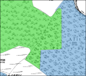
Welsh Government data scientist Evie Brown kicked off the morning with a fascinating talk on identifying historic woodlands shown on the first edition of the Ordnance Survey (OS) 25-inch map using computer vision (a form of artificial intelligence).
The project was commissioned by Cadw to help identify areas of Ancient Woodland and lost woods. This information can be used to protect existing woods, inform replanting efforts, and support the delivery of the National Forest for Wales, as well as enable the historic data to be queried in new ways. The output is available on DataMapWales, the central repository for Welsh public sector mapping.
The computer vision model was trained on samples of Landmark data (which is derived from scans of 19th century OS maps made in the 1990s). The model was then set loose on the full Landmark first edition OS 25” dataset for Wales.
You can read more about the technical side of this project here: https://wgdsu.github.io/Woodland-AI-1/

The model was able to differentiate between the different symbols for woodland used on the OS maps (broadleaf, conifer, orchard etc.), although it had trouble with poorly printed symbols and intersections with other map data such as labels and boundary lines. Evie stressed that the data represent an estimate of woodland coverage as shown on the OS map and should not be used in isolation, but rather as a first step. A heartening by-product of this project was the identification of several woodlands that had grown rather than shrunk!
RCAHMW’s Freya Canham and Bethan Evans followed Evie with a look at the georeferencing of Welsh enclosure maps. RCAHMW has been visiting archives around Wales to locate maps of historic enclosures as part of a 9-month project to improve accessibility to this rich source of historical information through a comprehensive digitisation and georeferencing project. Most of these maps were brought to NLW in Aberystwyth to be digitised, combining them with the significant collection of enclosure maps already in the Library’s collection. RCAHMW staff then georeferenced the images in ArcGIS so users can overlay the historic maps on a modern basemap.
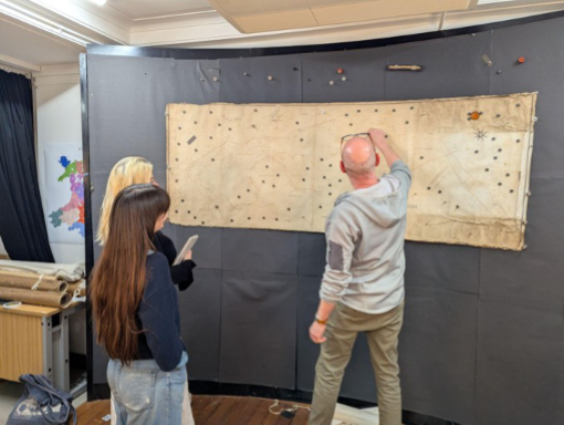
These maps cover the period of parliamentary enclosures in the 18th – early 20th centuries. Land that had been held in common for the use of was brought under the control of private owners. This removed common access to the land, including curtailing customary rights such as grazing and gleaning which had been part of rural life for centuries. Enclosure instead concentrated land ownership, usually to the benefit of the already-wealthy landowners and gentry. Enclosure at this time required an Act of Parliament to be legitimate. These enclosure acts were usually accompanied by a map and a detailed document listing the official boundaries and owners. As well as providing a detailed snapshot of the time in which they were produced, these maps also open a window to the pre-enclosure environment and landscape by enabling researchers to separate boundaries that were created to enclose land from those that existed before, some of which date back to the medieval period and beyond.
Enclosure maps can be large and unwieldy, as well as fragile. They are also often divorced from their geographical context as only fields of relevance to the act were mapped. Georeferencing these maps represents a significant step forward in making the maps legible and accessible to researchers.
This project has built on the success of the Deep Mapping Estate Archives resource, which brings together 400 years of historic mapping in Flintshire and Denbighshire onto a single web map and is a step towards creating a digital historic atlas for the whole of Wales. The enclosure map dataset will be available on Historic Wales in the coming months.
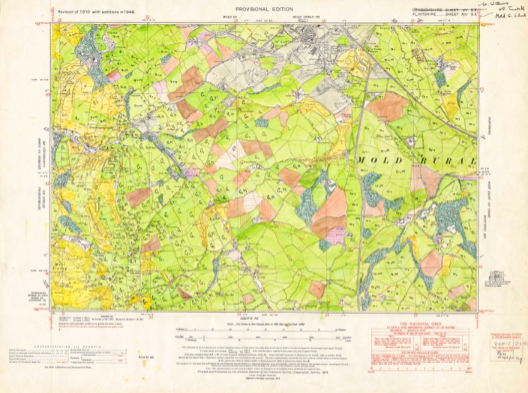
Rounding off the morning was NLW’s own map curator, Huw Thomas. Huw took us on a tour of the environmental mapping held in the National Library’s collection, starting at the bottom with bedrock geology and working upwards through groundwater, soil, land use and habitats and finally reaching the skies with weather maps. These were produced daily, so we were able to see the weather in the north Atlantic ‘on this day’ (15 May) in 1972 – wind at 10 knots and cloudy for Cardigan Bay.
Huw ended his talk with the Aberfan Special plan. 2026 marks the 60th anniversary of the Aberfan disaster: on 21 October 1966, a coal tip above the village of Aberfan collapsed, sending an avalanche of slurry down the hillside, burying houses and Pantglas Junior School. 116 children and 28 adults died. The special plan was made from an air survey taken on 26 October, only five days after the disaster, as part of the subsequent inquiry. The tip had been sited over a stream which contributed to the collapse. The stream was marked on OS maps available before the tip’s creation, which helped the tribunal conclude that the disaster could have been avoided – environmental mapping ignored to disastrous effect. To commemorate the anniversary, NLW commissioned poet Grug Muse to write a response to the Aberfan maps. Huw closed his talk by playing a recording of the poet reading her work in Welsh and English over a display of the maps.
Bruce Mitchell of the Office for National Statistics (ONS) presented the first afternoon talk, delving into the 1961 Second Land Utilisation Survey. Work on locating and digitising this survey initially started as part of the ONS’s Historic Censuses Digitisation Project to fill a data gap, but it proved a fascinating journey of discovery.
There had already been a land utilisation survey carried out by Dudley Stamp in the 1930s, and it was used extensively in converting additional land to grow food during the second world war. You can view every sheet, digitised and georeferenced on the National Library of Scotland’s map viewer. Stamp’s maps were published at a scale of 1:63,360 (one inch to the mile), which enabled comprehensive coverage, but could not display the finest detail.
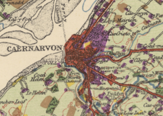
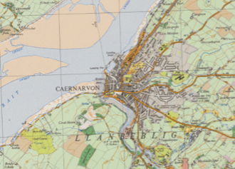
Geographer Alice Coleman was inspired by Stamp’s survey, but she started a much more ambitious project in the 1960s. Data was recorded on field sheets at 1:10,560 scale (six inches to the mile) and published at 1:25,000. Coleman’s survey included more than 70 classifications of land use on each map, compared to the seven categories used by Stamp. The larger scale allowed for a greater level of detail but was much more expensive. As a result, only 119 sheets were published, of the more than 840 planned.
However, the data was not lost. When Coleman retired from her professorship at King’s College London, she took home 10 tonnes of material, which had been filling 13 rooms at King’s. She bought the house next door to her home in Dulwich to store it all and opened it as a study centre. This material included a full set of land utilisation field survey sheets for England and Wales. Coleman died in 2023, but Bruce was able to get permission from her family to view her archive (stored in the garage) and organised a rescue of the material with the assistance of ONS, Defra, the UK Centre for Ecology & Hydrology, the National Library of Scotland (NLS), and Coleman’s family. The field maps and the published sheets from Coleman’s survey can now be viewed on the NLS website.
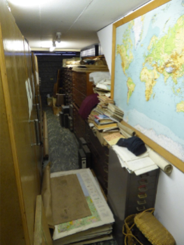
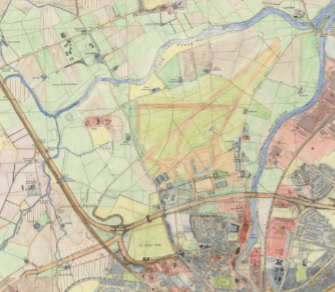
The 7000 hand-coloured map sheets Bruce recovered from Dulwich were produced by over 3000 volunteer surveyors, including school children, and are a rich source of land use and agricultural data. Some areas were revisited multiple times, which allows researchers to track different phases of crop rotation systems, as well as showing urban grown between published OS editions.
Queries were raised at the time about the accuracy of the data, given that much of it was derived from school children (under the supervision of their teachers and a small number of professionals). Dudley Stamp’s survey had also used children. He regarded primary school children as the best possible surveyors as they were intimately familiar with their local landscape, while older children and students got less and less useful! When Coleman was queried on her data by OS (based on the total area of ponds), her results proved more accurate, as the OS has disregarded ponds below a certain size.
The land use maps shown in Huw’s talk are sheets from this survey. Alice Coleman was working with James A Taylor at Aberystwyth University in the early part of the project, but their working relationship seems to have soured quickly, resulting in Aberystwyth University retaining a separate set of field maps – these are the maps that are now held in the National Library.
Rounding off the day was senior environmental consultant Dr Gemma Bell of Environment Systems. Gemma did a beautiful job of describing the importance of historic environmental data in combatting shifting baseline syndrome. Wales is one of the most nature depleted nations on the planet – 18% of our species are at risk of extinction, and abundance of land and freshwater species has fallen by 20% since 1994 – but if no-one remembers the abundance that was once here, the starkness of the decline is hard to visualise. Historic data is the antidote to this, if it is accessible. Environment Systems have worked on several projects that aim to extract data from historic records and reconfigure them to work within modern environmental management systems.
A recent Environment Systems project for Natural England looked at coastal vegetated shingle: a unique and fragile habitat, globally rare and adapted to survive in harsh conditions. An inventory was taken in the 1980s and 1990s, including copious maps, but in their paper published format, they were inaccessible to most people and extremely difficult to interpret. Environment Systems scanned and georeferenced the maps (no mean feat in a landscape as changeable and apparently featureless as coastal shingle!), digitising the habitat boundaries and connecting them to a universal habitat classification system. This work made the data compatible with modern systems and allowed it to be incorporated into Natural England’s GIS workflows.
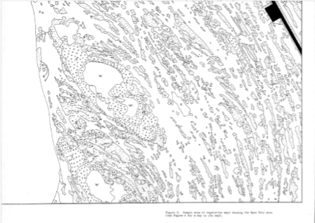
This project, and the importance of keeping data in accessible formats, drew a neat parallel with Bruce’s talk. He discussed the production of the Wildscape Atlas, which began as a spin off project from Alice Coleman’s land utilisation survey. Coleman described wildscape as “mountain and moorland, heath and coast, bog and fen, all the areas that spring spontaneously to mind at the mention of nature conservation”. The atlas itself was never published. It was nearing completion when the Wapping printers’ dispute broke out in 1986. Publisher Rupert Murdoch switched wholesale from hot-metal Linotype printing on Fleet Street to computer compositing at a new plant in Wapping with little notice to staff, having led the unions to believe the Wapping plant would print a brand-new paper. 6,000 dismissal notices were issued as soon as a strike was called, making every striking worker redundant and avoiding any redundancy payments. The printers were on strike for more than a year — longer than the miners — but to no avail.
As well as delivering a stark defeat to the union movement, the switch to computers killed the Wildscape Atlas, as reformatting the material for the new system was prohibitively expensive. Some of the data is available on data.gov.uk and further digital releases may be forthcoming, more than 40 years after the original was rendered unproduceable by changes in technology and industrial warfare.
Looking again to the future, Environment Systems have been assisting Parc Cenedlaethol Arfordir Penfro | Pembrokeshire Coast National Park in meeting Welsh Government’s ‘30 by 30’ goal within the national park – 30% of land managed for nature by 2030. Their work mapping habitats and protected areas has enabled the park to create a set of criteria to judge sites and their contribution to the 30 by 30 project and track each site’s progress towards these goals. Environment systems have created a series of maps identifying opportunities for the expansion of a wide range of habitats, from oak woodland to heaths and grassland allowing the park to find easy wins as well as create longer term plans.
Gemma’s talk was well named, and could describe the day itself: Looking backwards, looking forwards. All our speakers demonstrated the immense power of accessible environmental mapping both for understanding the past and setting course for the future and the lively Q&A sessions after each talk demonstrated the vibrancy of their ideas and their relevance to people’s lives.
Ellie King, Assistant Map Curator
---
Carto-Cymru is Wales’ annual map symposium, held in partnership by the National Library of Wales (NLW) and the Royal Commission on Ancient and Historical Monuments of Wales (RCAHMW). Carto-Cymru 2026 was sponsored by Environment Systems.
Category: Article