Teacher Toolkit
Background
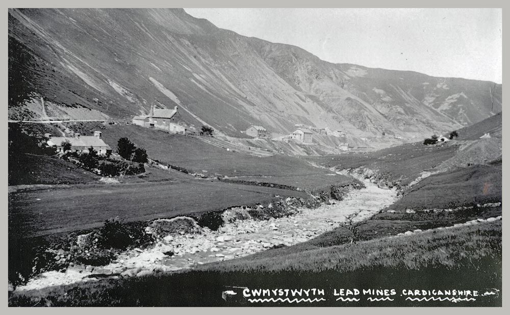
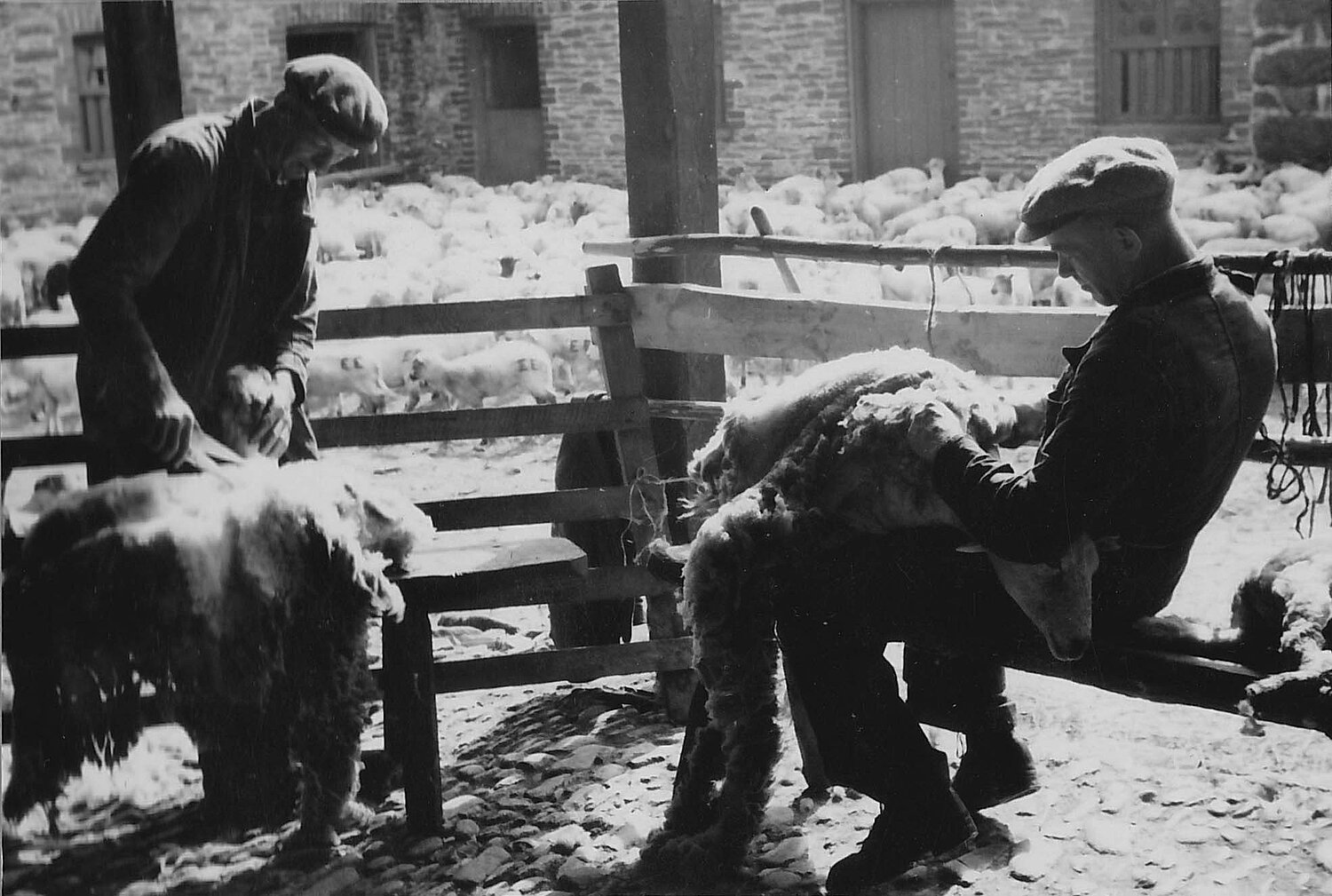
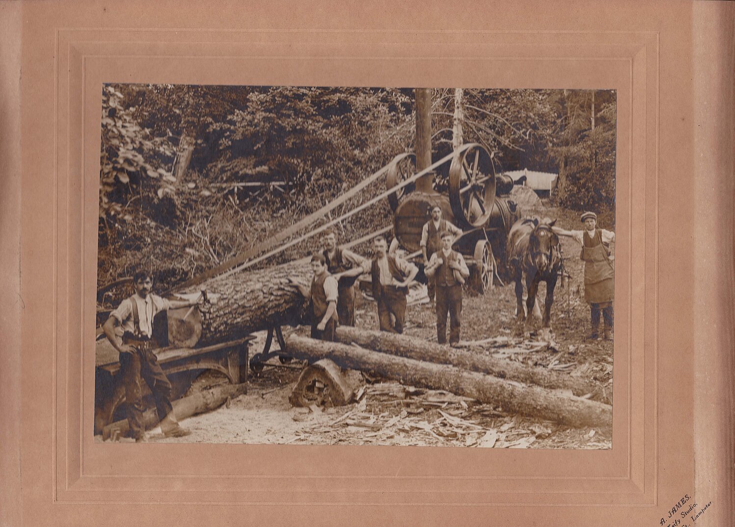
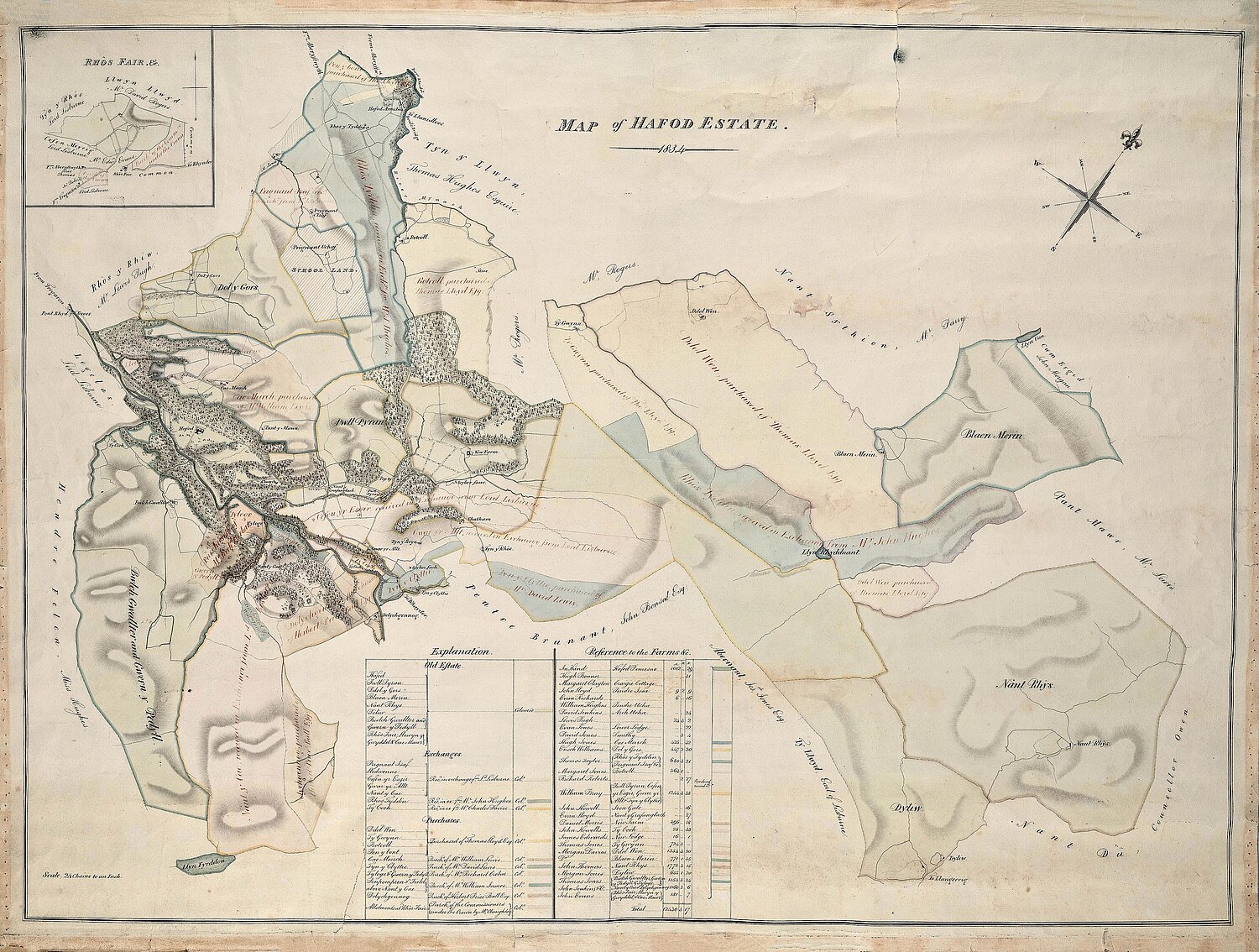
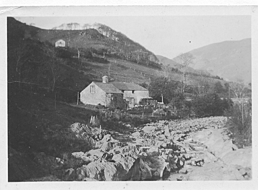
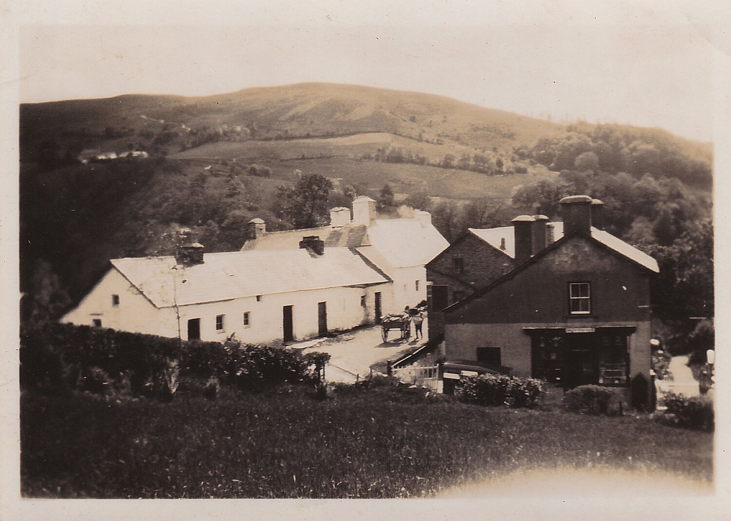
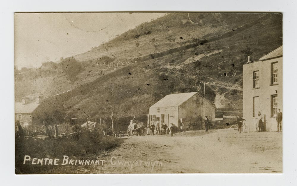
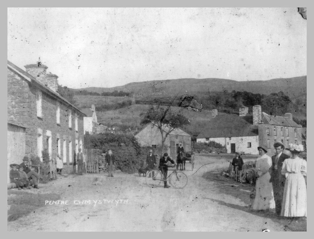
Today, Cwmystwyth may appear to be a quiet rural farming area with a small population. However, when learners explore its past, they discover that this valley was once a busy and lively place. In earlier times, people travelled through Cwmystwyth every day for work, worship, education and trade. The lead mines, chapels, schools, shops, the Hafod Estate, and the many farms and smallholdings all played a role in shaping a community full of activity and purpose.
Over time, Cwmystwyth has changed. Today it is a small village, and many people who live here have moved from other places, often from outside Wales. Apart from farming families, relatively few residents were born and raised in the valley itself. This creates valuable opportunities for learners to explore questions about identity, belonging, and place. It also became clear that the stories, photographs and memories of the area, built up over centuries, were at risk of being lost.
To respond to this, a small group of local people began collecting old photographs, documents, maps and recordings. Their aim was to safeguard the history of Cwmystwyth and create a digital community archive that could be used by future generations. This led to the establishment of Cofnodion Cwmystwyth in November 2006, following a meeting at Ysgoldy Goch.
Working alongside the National Library of Wales and Casgliad y Werin Cymru, Cofnodion Cwmystwyth now holds over 1,000 items. Learners can use these sources to ask questions, investigate change over time, and develop skills in historical inquiry, interpretation and evaluation. Community sessions held with Cymdeithas Cwmystwyth a’r Cyffiniau allow people to identify photographs, buildings and Welsh place names, showing how shared knowledge builds understanding.
Through studying records like these, learners see how history is constructed from real evidence. Exploring the past of Cwmystwyth helps them understand their cynefin, reflect on the present, and consider how communities can shape a sustainable and inclusive future.
People's Collection Wales
Possible questions to discuss
- What places in your local area are the most important to you, and why?
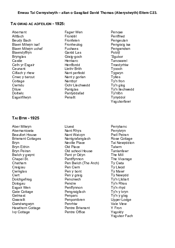
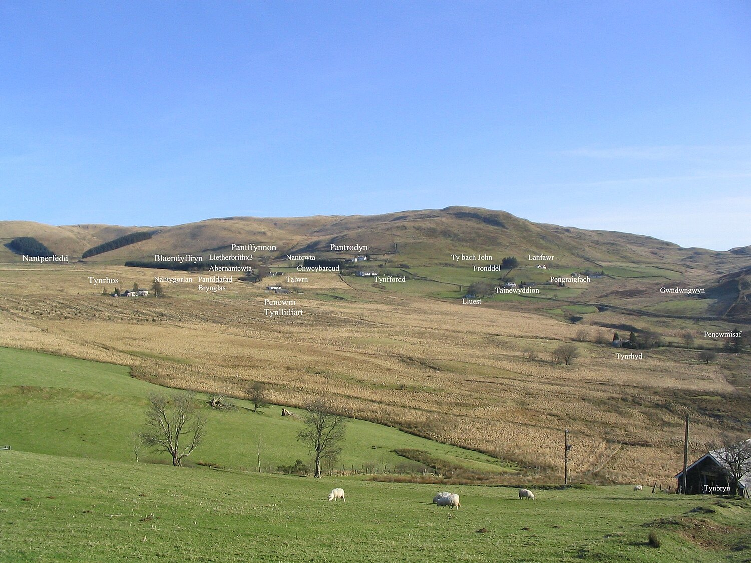
- How many local fields, houses or streams can you name? What are their names?
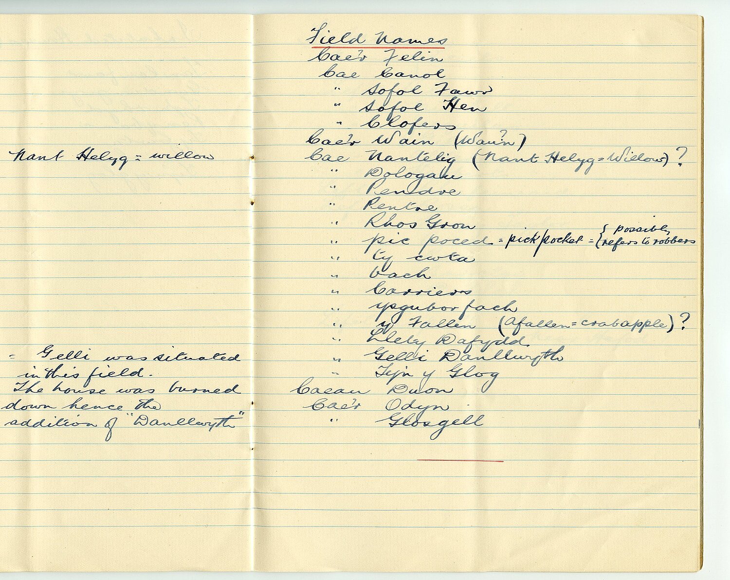
- Which local place names are you curious about? What do you think they might mean or where might they come from?
- Are there buildings, paths, bridges, or landmarks in your area that look old? What do you think they were used for in the past?
- Can you think of anything in your village/town that has changed since your parents or grandparents were young?
- Why do you think your community developed where it is? (Near a river? Roadway? Farm? Industry?)
- What natural features (rivers, hills, fields, coastlines) have shaped how your area looks and how people live?
- How do you think life in your local area would have been different 100 years ago?
- What stories or memories do people in your family have about where you live?
- Are there any local traditions, festivals, or community events that feel unique to your area?
- What would you like future generations to know about your community? What should be remembered?
Activities and experiences
• Place-name detective work: Pupils choose local names (fields, farms, lanes, streams, houses) and research their origins — Welsh, Norse, Norman, English, descriptive, personal names, etc.
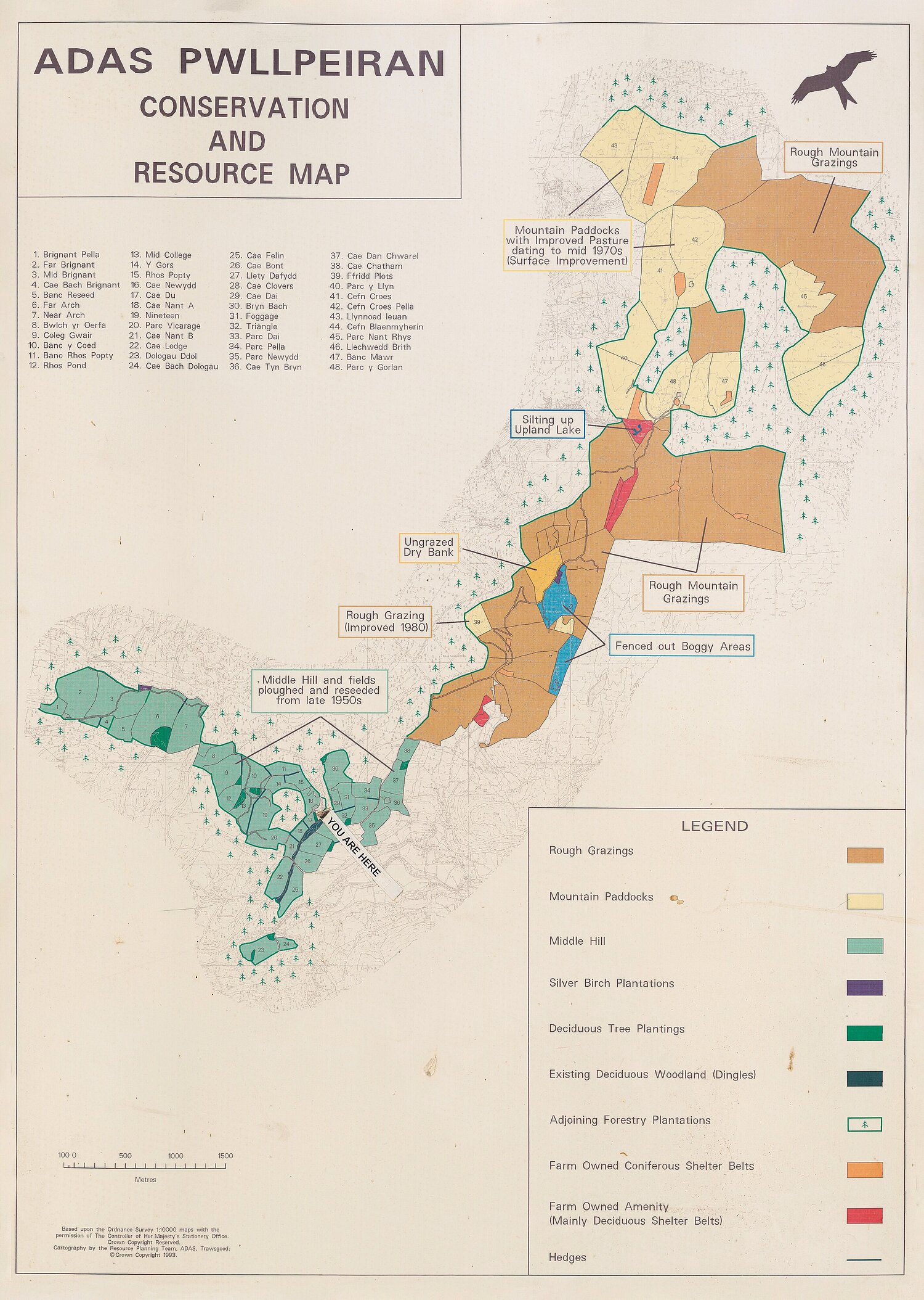
• Create a “Local Names Map”: On a large printed map or digital map, pupils pin their research and add drawings or icons that illustrate the meaning of each name.
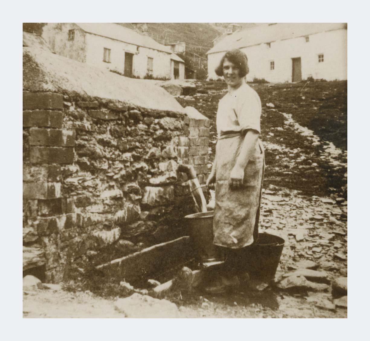
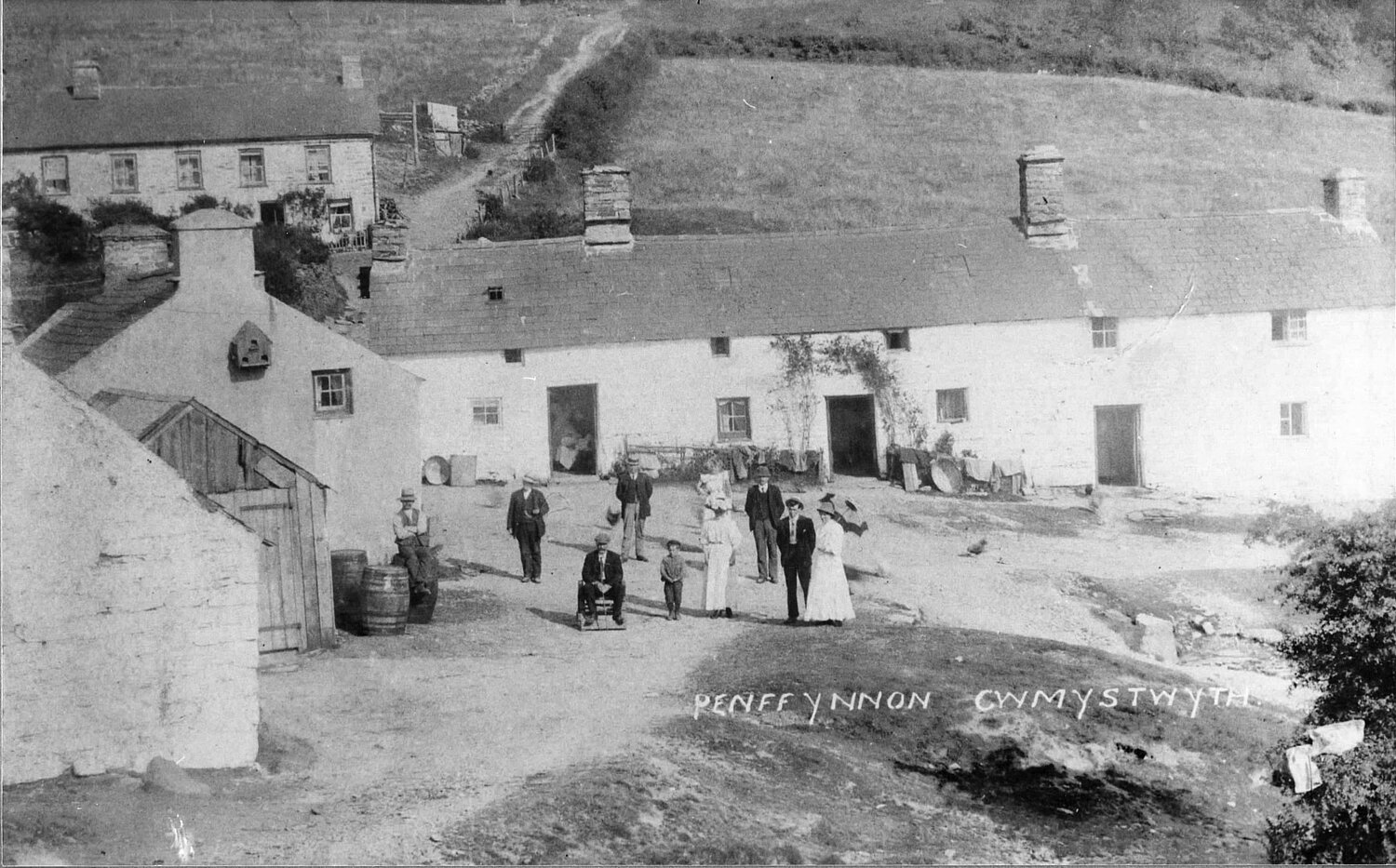
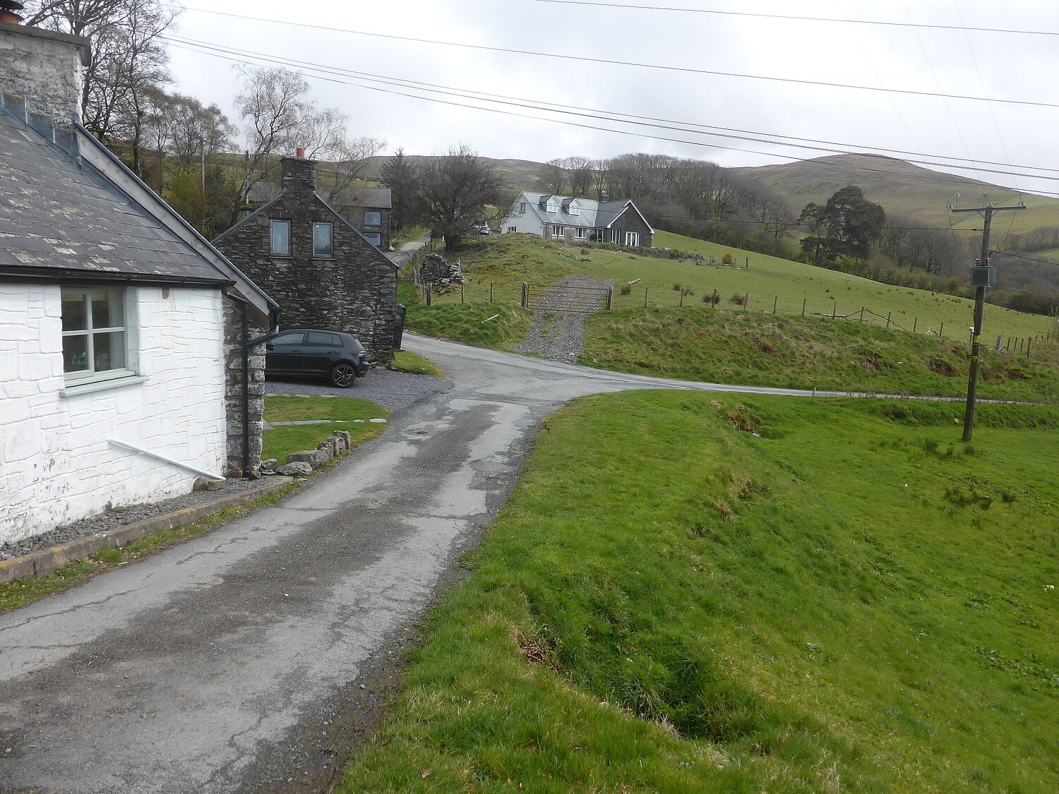
• Then & Now Photo Comparison: Pupils bring in old photos from home/local archives OR use online archives. Compare with modern photos taken by the pupils.
• Memory interviews: Pupils interview an older relative or community member: What was the village like? What’s changed? What’s stayed the same?
• Reconstructing the Past: Pupils draw or model (e.g., in LEGO or cardboard) what they think the village looked like 50, 100, or 200 years ago.
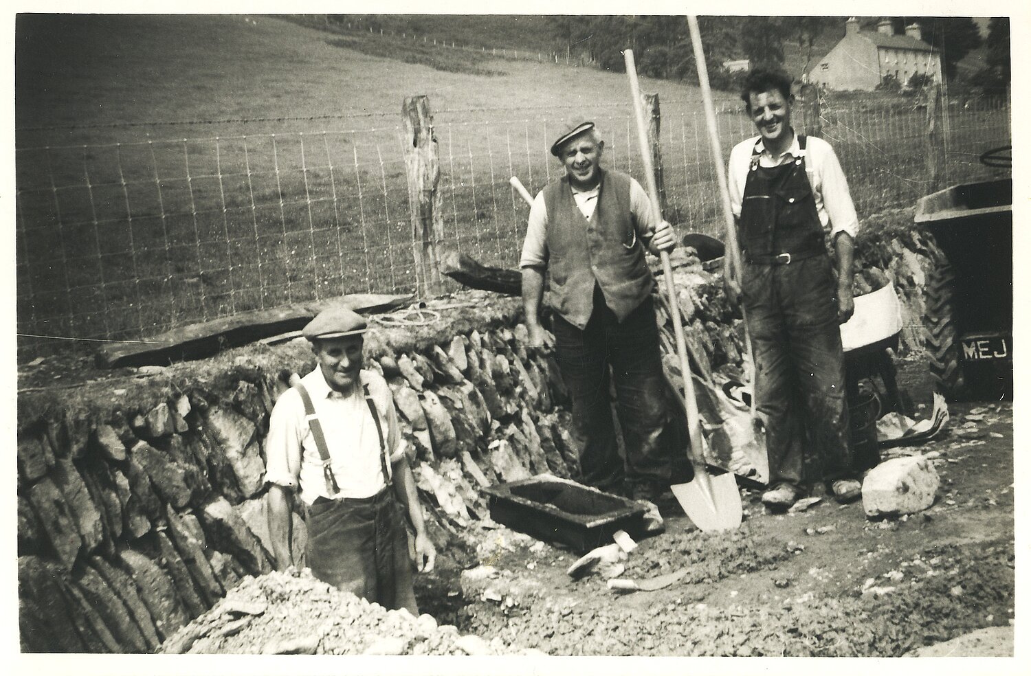
• Local fieldwork walk A guided walk to spot clues about the past: old walls, styles, bridges, wells, mills, chapels, boundaries.
• Sounds of the Square Mile: Pupils record the natural and human sounds of the local area: birds, cars, machinery, river, schoolyard. Create a “sound map” of the village.
• Make a “People of Our Place” book: Pupils write short profiles of real or imagined people connected to the area: a miner, a farmer, a shopkeeper, a grandmother, a schoolchild from 1900, etc.
• Local Legends & New Legends: Study any local myths or folklore. Then have pupils write their own story set in their village.
• Create a Class “Chronicle” of the Square Mile: Inspired by Community Records — pupils compile: Photos, drawings, maps, interviews, place‑name explanations, memories and short stories
Key concepts
(derived from the statements of what matters)
Humanities:
- Investigate
- Interpret
- Change and continuity
- Places
- Human Impact on the World
- Identity and Diversity
- Cause and effect
- Justice, inequality and rights
- Social Action
- Ethical and moral questions
Health and Wellbeing:
- Communication, Help Seeking and Empathy
- Informed Choices and the impact of decisions
- Social Influences and Norms
- Identity and Values
- Rights and Respect
Language, literacy and communication:
- Reading Strategies
- Drawing conclusions
- The effect of grammatical constructions of the meaning of texts
- Responding to texts
- Vocabulary Development
- Communicate ideas and opinions (Oral)
- Collaborate and negotiate
- Writing for different purposes and audiences